Gornergrat: The Ultimate Matterhorn Panorama
Geographical Context and Altitude
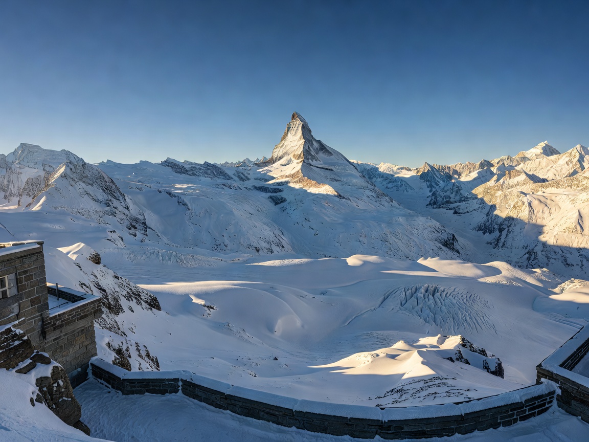
Situated at 3,089 meters above sea level, the Gornergrat rocky ridge is one of the most significant vantage points in the Swiss Alps. Unlike lower-altitude viewpoints that are dominated by foreground topography, Gornergrat places observers at an altitude that directly competes with the surrounding peaks. From the viewing platforms, visitors can identify 29 mountains exceeding 4,000 meters in elevation. The visual field encompasses the Monte Rosa massif, featuring Switzerland's highest peak, the Dufourspitze, and offers an unobstructed, iconic alignment with the east and north faces of the Matterhorn.
The Gorner Glacier, the second-largest glacier system in the Alps, flows extensively beneath the ridge. The proximity to this massive ice flow provides a stark demonstration of glacial mechanics, moraine formation, and the raw scale of high-alpine geology. Due to the high altitude, the environment is barren, defined by rock, snow, and ice, emphasizing the starkness of the panorama.
The Ascent: Gornergrat Bahn
The journey to the summit is integral to the experience. The Gornergrat Bahn, Europe's highest open-air cog railway, departs directly from Zermatt (1,620m). Operational since 1898 and uniquely electrified from its inception, the train climbs 1,469 meters over a track length of 9.3 kilometers. The ascent takes approximately 33 minutes.
The engineering of the track utilizes the Abt rack system to manage gradients of up to 20%. As the train climbs, the vegetation zones shift rapidly—from the larch and Swiss stone pine forests of the lower slopes to the alpine tundra above the tree line. The right side of the train (when facing uphill) generally offers the most continuous views of the Matterhorn during the ascent.
Seasonal Variations and Hiking Infrastructure
The character of the Gornergrat panorama changes dramatically between seasons. During the winter months (December to April), the region operates as a high-altitude ski resort, connecting seamlessly with the broader Zermatt-Matterhorn ski domain. The viewpoint is accessible to non-skiers, offering pristine, snow-covered vistas and access to the temporary igloo village situated slightly below the summit at Rotenboden.
In summer, the melting snow reveals a network of high-alpine hiking trails. The most prominent route is the descent from Rotenboden station to the Riffelsee. At 2,757 meters, this small alpine lake is renowned for capturing a perfect reflection of the Matterhorn on calm, windless days. Hiking trails vary from well-maintained, wide gravel paths suitable for casual walkers to challenging alpine routes traversing boulder fields.
Key Summer Hiking Routes
| Route Name | Start Point | End Point | Duration | Difficulty |
|---|---|---|---|---|
| Riffelsee Path | Rotenboden (2,815m) | Riffelberg (2,582m) | ~1 hour | Easy / Moderate |
| Gornergrat - Riffelsee | Gornergrat (3,089m) | Rotenboden (2,815m) | ~40 minutes | Moderate (Steep descent) |
| Hohtälli Panorama | Gornergrat (3,089m) | Hohtälli (3,286m) | ~1.5 hours | Challenging |
Facilities and Practical Considerations
The summit infrastructure is anchored by the Kulmhotel Gornergrat. At 3,120 meters, it holds the distinction of being the highest-altitude hotel in the Swiss Alps. The structure features distinctive astronomical observatory domes, originally built in the late 1960s to capitalize on the exceptionally clear, dry air of the Valais region.
When planning a visit, consider the meteorological conditions. High altitude means weather can shift rapidly, and temperatures are significantly lower than in the valley. Even in peak summer, wind chill can make the viewing terraces cold. Furthermore, the rapid ascent to 3,000+ meters can trigger mild altitude symptoms in sensitive individuals; staying hydrated and moving at a measured pace upon arrival is advised. The Swiss Travel Pass offers substantial discounts on the Gornergrat Bahn fare, though seat reservations are generally not required except for large groups.