Harder Kulm: The Interlaken Observatory
The Geometric Perfection of the Bernese Oberland
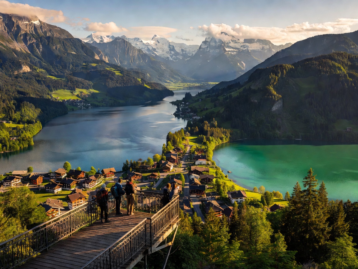
Harder Kulm occupies a unique position in the geography of the Bernese Oberland. At 1,322 meters, it is not particularly high by Swiss standards, yet its strategic placement on the ridge of the Harder mountain directly above Interlaken provides an unparalleled symmetrical panorama. Looking south, the observer is presented with a textbook geographic cross-section: the Bödeli (the alluvial plain on which Interlaken sits) is flanked precisely by Lake Brienz to the east and Lake Thun to the west. Directly ahead, the Lütschine valley acts as a visual corridor leading the eye up toward the monumental Eiger, Mönch, and Jungfrau peaks.
This layout makes Harder Kulm an excellent introductory viewpoint. It offers immediate spatial orientation to visitors arriving in the Jungfrau region, laying out the lakes, valleys, and high-alpine ridges in a single, comprehensive frame. The lower altitude also means the viewpoint is often situated below the cloud layers that frequently obscure the higher 4,000-meter peaks, ensuring reliable visibility.
The Two Lakes Bridge (Zwei-Seen-Steg)
The primary infrastructural draw of the summit is the Two Lakes Bridge. This viewing platform, constructed in 2011, juts out over the steep forest slope below. Its design features a sharp, angular protrusion with a glass floor panel at the apex, allowing visitors to look directly down onto the funicular tracks and the town of Interlaken below.
The platform is engineered to maximize the panoramic arc, offering unobstructed sightlines from the turquoise waters of Lake Brienz across the forested ridges of the Schynige Platte, terminating at the deep blue expanse of Lake Thun. Photography here is best in the late afternoon or evening, as the setting sun illuminates the snowcaps of the Jungfrau massif while throwing the deep valley into dramatic shadow.
Ascent via the Harderbahn
The summit is accessed via the Harderbahn, a funicular railway that has been in operation since 1908. The base station is conveniently located just a short walk from Interlaken Ost railway station. The funicular overcomes an elevation gain of 735 meters over a track length of 1.4 kilometers, maintaining an average gradient of 64%.
The journey takes just 10 minutes. The carriages are designed with a stepped configuration and large panoramic windows, ensuring that passengers face downhill toward the expanding view during the ascent. The track layout is largely concealed within the forest, emerging into daylight primarily near the summit, providing a sudden and dramatic reveal of the landscape.
Comparative Access Data
| Metric | Harder Kulm Details |
|---|---|
| Base Elevation | 567 m (Interlaken Ost) |
| Summit Elevation | 1,322 m |
| Transit Time | 10 minutes (Funicular) |
| Operating Season | Typically April to late November |
Facilities and Surrounding Hikes
At the top station, visitors find the Panorama Restaurant Harder Kulm, distinguished by its turreted, castle-like architecture which dates back to the opening of the railway. The restaurant features a large sun terrace that serves as an extension of the viewing platform.
For those interested in hiking, Harder Kulm serves as the trailhead for several prominent routes. The most challenging and rewarding is the Hardergrat trail, a highly exposed and demanding ridge hike leading towards Augstmatthorn. Due to steep drop-offs on both sides, this specific trail is strictly for experienced alpine hikers. More accessible forest trails zigzag down the mountain back to Interlaken, offering a shaded descent that takes approximately two hours.